Projects
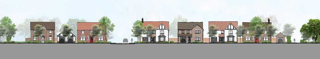
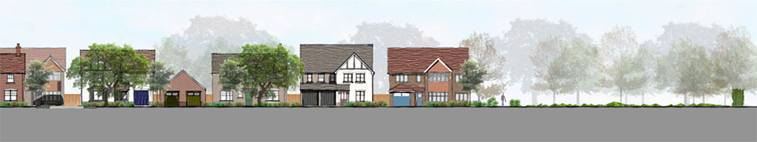
Hall End Road, Wootton, Bedfordshire
Scale: 16.0 acres (6.5 ha)
The outline planning application is for residential development for up to 81 dwellings with access off Hall End Road in Wootton, Bedfordshire. The site is situated approximately 950m west of Wootton village centre and, coupled with the site’s proximity to bus stops, schools, cycle routes and viability to access the nearest rail station, accessibility from the site is considered to be of a good standard with opportunities to promote sustainable travel from the site. The northern edge of the site is defined by Hall End Road (also National Cycle Route 51) and the John Bunyan Trail. There is a field access gate to the northeast corner of the site. From this direction, the settlement of Wootton has recently been expanded towards the site with the construction of 58 dwellings (Ref: 14/02939/MAF) (Allocation AD2) and is a prominent feature. An allocation for a school extension is also located north of the site.
The eastern boundary runs alongside an unnamed road that provides access to Wootton Upper School and commercial/ farm premises. The southern boundary is contiguous with Wootton Wood, an area of ancient and semi-natural woodland. The western boundary is shared with an adjacent field, laid to pasture. These boundaries are formed from native hedgerow with a combination of post and rail or wire fencing within.
Benefits of the proposal:
- The delivery of open market housing to assist in boosting the supply of housing in Bedford where the housing supply is 3.7 years.
- Delivery of a medium sized site by an applicant with a proven track record of delivery which would accord with the clear objective of the Government in paragraph 68 of the Framework and is a benefit which should be given significant weight;
- Whilst outside the Settlement Policy Area, the development accords with the spatial strategy as expressed in Policy CP4 of the Core Strategy which identifies Wootton as one of the three Key Service Centres in the Milton Keynes & South Midlands Growth Area;
- The proposed development helps to meet the objectives set out in the Bedford Green Infrastructure Plan (2009);
- Residential development at the site can be achieved with no materially adverse effect on designated sites for nature conservation and ecologically valuable habitats.
- Creation of great crested newt breeding ponds, hedgerow planting, hibernacula and enhanced habitat connectivity through the site;
- Retention of 52% of the site area for ecological enhancements including long-term management of neutral grassland and hedgerow;
- Habitat creation within the built environment to provide opportunities for fauna such as roosting bats and nesting birds;
- The delivery of 30% affordable housing which accords with Policy CP8 and would assist in addressing the very significant and persistent shortfall in affordable housing delivery. There is a shortfall of 552 affordable homes since 2003 and the need going forward is 278 affordable homes per annum. This is a significant benefit;
- A socially, economically and environmentally sustainable development in an accessible location;
- The provision of open space to meet the needs of existing and proposed residents and maintain a Green Corridor as required by AD24; and;
- A range of social and economic benefits including the provision of New Homes Bonus, CIL, Council Tax revenue now, construction jobs and increase spending for local services and facilities.